You are viewing a plain text version of this content. The canonical link for it is here.
Posted to dev@echarts.apache.org by GitBox <gi...@apache.org> on 2019/03/15 10:21:17 UTC
[GitHub] [incubator-echarts] deyihu commented on issue #10094: map polygon
not support hole, Map rendering does not reflect the existence of holes
deyihu commented on issue #10094: map polygon not support hole,Map rendering does not reflect the existence of holes
URL: https://github.com/apache/incubator-echarts/issues/10094#issuecomment-473232963
@deqingli
Yes,
This function can be achieved by using custom series.
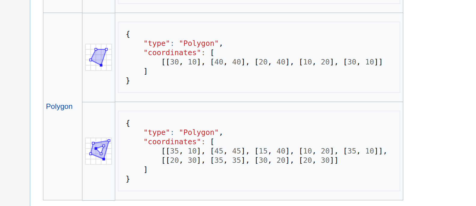
But I think it's a geojson specification.
Because echarts uses geojson's data format,
So I think echarts map component should support this function by default.
Although polygons in this situation are not very common, there are still some, such as an island in the middle of a lake.
At this point, the polygon of the lake must hollow out the island.
About Wikipedia
Https://en.wikipedia.org/wiki/GeoJSON
----------------------------------------------------------------
This is an automated message from the Apache Git Service.
To respond to the message, please log on to GitHub and use the
URL above to go to the specific comment.
For queries about this service, please contact Infrastructure at:
users@infra.apache.org
With regards,
Apache Git Services
---------------------------------------------------------------------
To unsubscribe, e-mail: dev-unsubscribe@echarts.apache.org
For additional commands, e-mail: dev-help@echarts.apache.org